
Finding GIS Data

How to Use Legislative Technology Services Bureau (LTSB) Data Portal
The Wisconsin State Legislature's Open Data Portal:
Homepage: https://data-ltsb.opendata.arcgis.com/
About: The Legislative Technology Service Bureau (LTSB) Open Data Portal exists to provide easily accessible open data of a legislative nature for the state of Wisconsin.
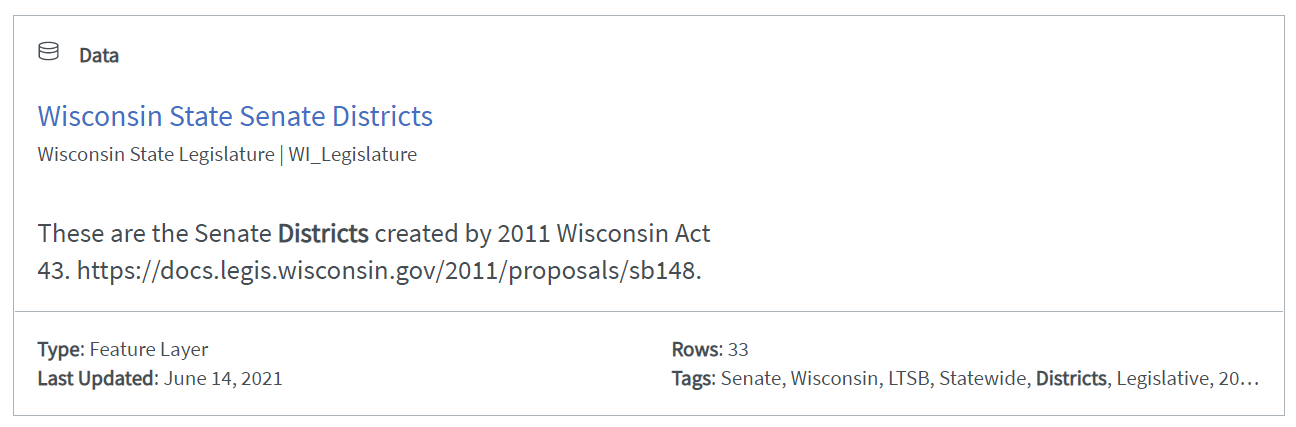
Data Available: Available on LTSB are freely downloadable spreadsheets (CSV), KMLs, GeoJSON, and shapefiles of Wisconsin.
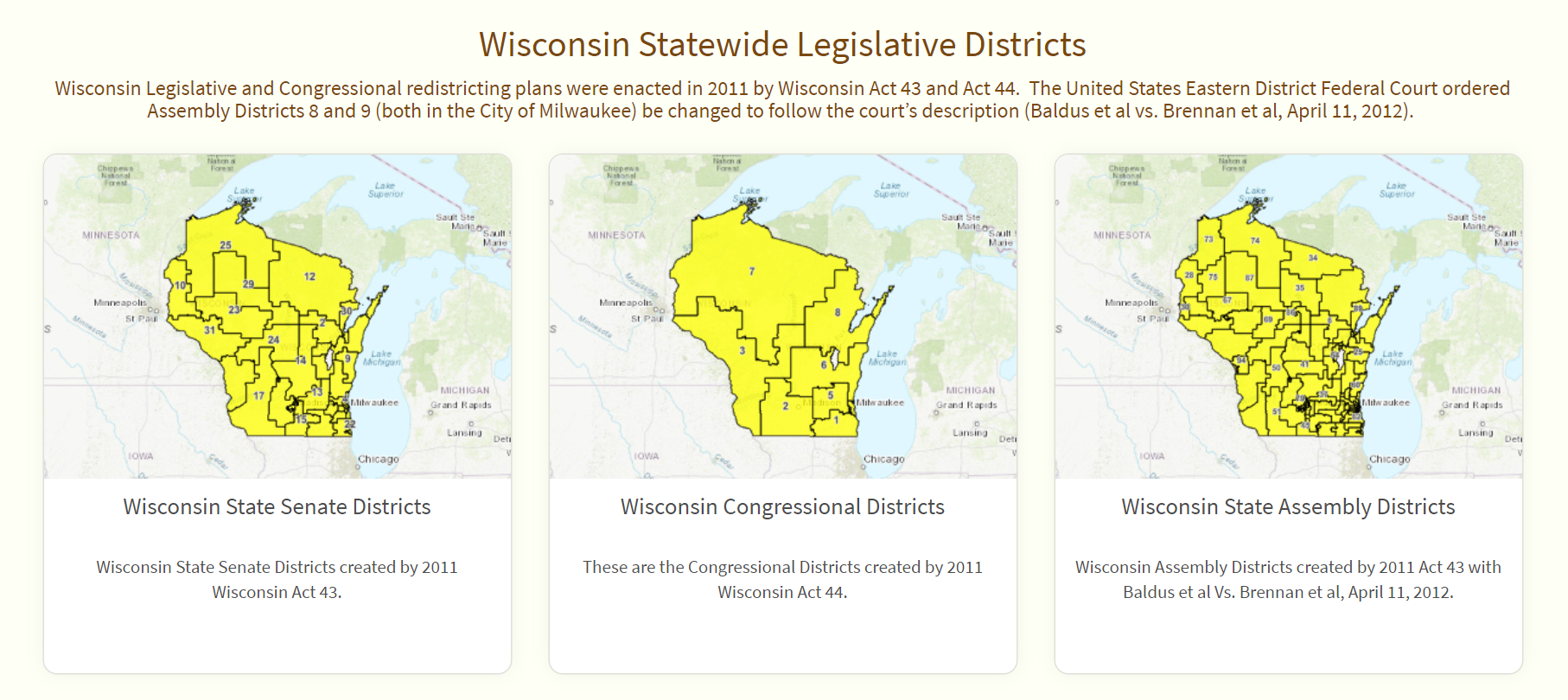
Topics Include: Legislative Districts, WISE-Decade, and Election Data
How to Use
How to Download:
1. Here you can download the following Wisconsin data sets:
-
Senate, congressional, and assembly districts
-
Municipal wards & boundaries (cities, towns & villages)
-
Election data dating back to 1990

2. Additionally, you can scroll to the bottom of the homepage to find some quick access data that LTSB has made available
3. Click the dataset that you need. (In this case we will use Wisconsin State Senate Districts)
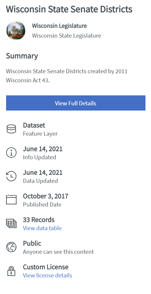
4. Click "View Full Details"
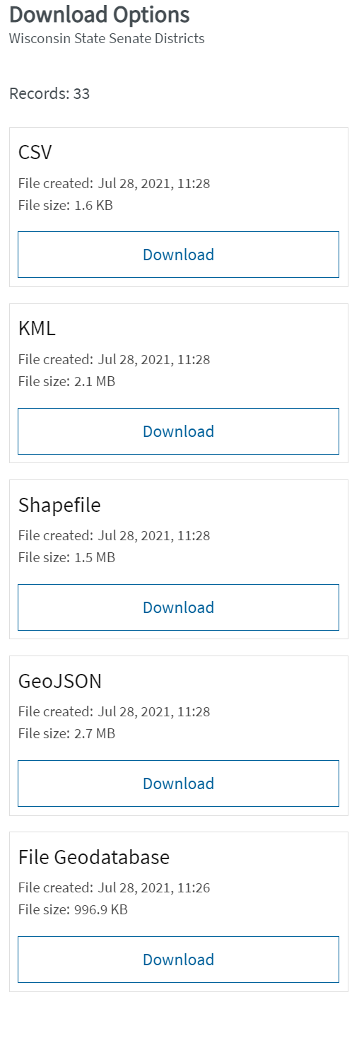
5. Click "Download"

6. Select which type is most applicable to your interests. (In this case we will use Shapefile)
Documentation:
In order to see metadata for some of the files, including information about how the data was collected, how to interpret the data, and who to properly cite, you may need to Login to ArcGIS Online using your UWM Account.

The Contents of Finding and Using GIS Data may be reused with attribution for Non-Commercial purposes.
Finding and Using GIS Data by Board of Regents of the University of Wisconsin System is licensed under a Creative Commons Attribution-NonCommercial 3.0 Unported License. 